The eastern Mediterranean is the cradle of the olive culture. The wild olive indigenous to this region developed through cultivation into the olive that we know today, with its various cultivars and characteristics.
Despite its modest size, the Land of Israel is geographically fascinating. Crossing it from north to south and east to west, one will pass no less than 4 climates: alpine, subtropical, semi-arid and desert, as well as a vast array of microclimates, all of which influence the nature of the cultivation, the olive varieties that can thrive in it, and subsequently, the organoleptic properties (aromas and flavors) of the olive oil produced.
Much like with wine or any other agricultural product, the combination of many factors, also referred to as ‘terroir’, determine the flavor of olive oil. The most prominent elements are the type of sunlight exposure (north, south, east or west facing), the geography (planting on spurs or in valleys), the soil’s drainage capacity, the size of the grains in the soil (clay, silt or sand), soil salinity, the temperature differences between day and night, the annual rainfall, the heat load during summer, winds, humidity, topographical height, and the olive variety, naturally.
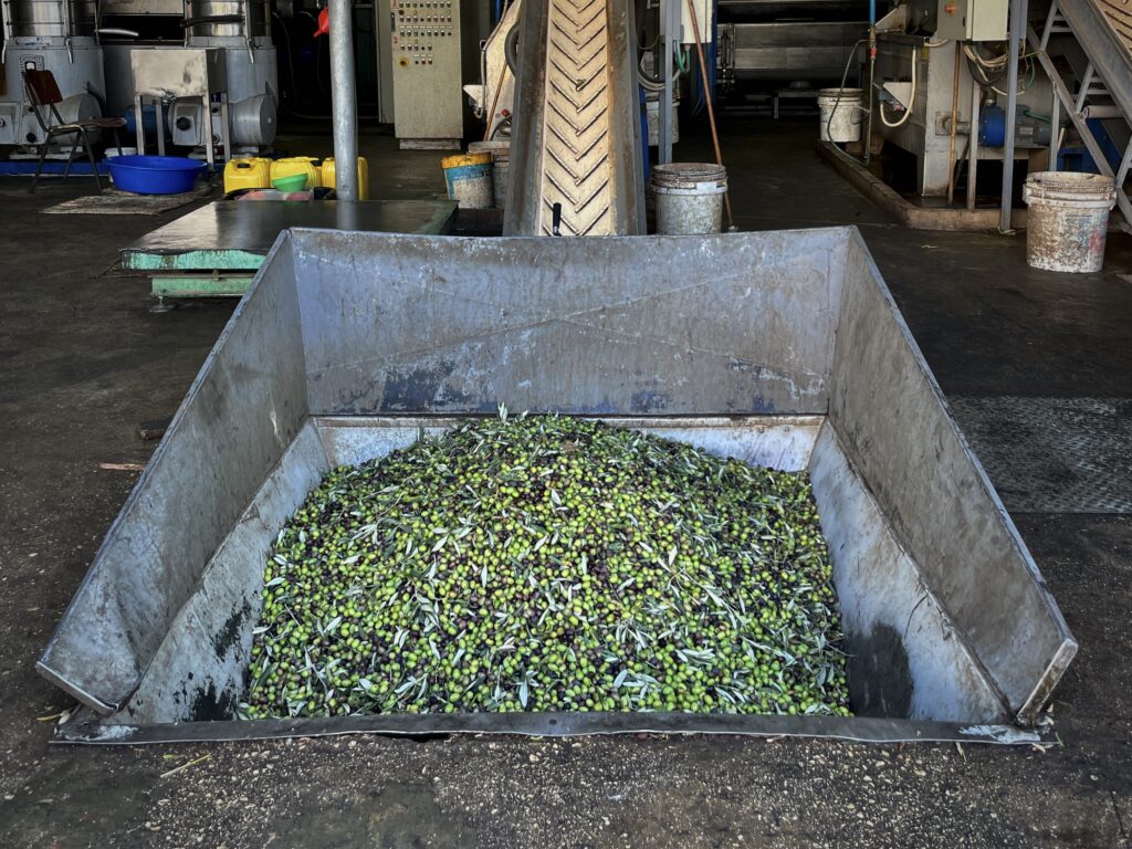
In the early 2000s, olive cultivation underwent a process of agricultural modernization; new areas of land were planted with new, previously uncommon varieties to the region, resulting in a plethora of new flavors and aromas. In this article I will refer to the most common olive varieties that can be found today, according to their geographical regions.
I have outlined five distinct terroirs that I believe are relevant to olive oil as well as other agricultural crops.
The Golan Heights
Regional boundaries: The plateau is bound by the Yarmouk River on the south and Nahal Sa’ar in the north, in the west it is bound by the Jordan valley and in the east, it continues into the Syrian plateau (the Bashan) without a clear geographical border.
The Golan Heights is a basaltic plateau spanning between 400-1,000 meters above sea level. Most of the area is covered in basalt with ancient limestone areas found only in the southern part, evidence to an earlier soil, prior to the volcanic eruptions that gave the plateau its unique character.
The Golan Heights region is usually divided into north-south regions (with the point of intersection being the waterfalls crossroad/Katzrin), but when it comes to agricultural crops, the terroir is divided along an east-west axis.
Grapevines in the east, olive groves in the west: the eastern part of the Golan Heights is set up like a topographical staircase facing east. The flat part of each ‘step’ is actually a swamp or a seasonal lake (depending on the seasonal precipitation); a pool of stagnant water with poor drainage. Deciduous dormant crops, such as grapevines, have no problem handling such wetlands, but for olives (as well as other evergreen trees), still water is a disaster. Their roots rot from lack of ventilation and the tree suffers and may even die if the water is not drained for long periods of time. Thus, one is unlikely to come across significant olive cultivation along the eastern part of the Golan Heights, as the terrain conditions are less than ideal.
It would seem nature and the local environment dictate our course of action far more than we realize, in ancient times as well as today.
Ehud Soriano
Where do the olives grow and thrive? In the western and southern part of the Golan Heights. The topography west of Highway 98 is a gentle slope facing the Sea of Galilee (until its dramatic drop above the Sea of Galilee and the Jordan and Yarmouk channels). Water drains from this slope with ease, an ideal area to cultivate olives with great success. Archeological surveys in the south and center of the plateau show just that: ancient olive presses are concentrated in the western part of the plateau, and ancient wine presses are concentrated in the eastern part. It would seem nature and the local environment dictate our course of action far more than we realize, in ancient times as well as today.
And the northern plateau? Most of it is covered with ‘young’ basalt stone unsuitable for agricultural crops. There are ‘pockets’ of ancient basalt on which agriculture can be sustained, but these are used for the cultivation of deciduous fruits. Hence the reason olives are less common in the northern part of the plateau compared to the south – where they have a greater advantage.
Archaeological evidence: Archaeological findings show the production of olive oil in the Golan Heights dates back to the Copper Age, about 6000 years ago. Throughout the history of mankind in the region, olives were cultivated and used for the production of oil mainly in the southern part of the Golan.
Varieties: Most of the agriculture in the Golan Heights is super-intensive (high density olives), as the large flat areas are ideal for such growth. Thus, the main varieties in the region are suitable for the cultivation of high-density orchards: Arbequina, Koroneiki, Askal and the latest purchase – Arbosana.
Harvest season: due to the region’s high topography, the harvest season starts relatively late- from November to January.
Organoleptic properties: Golan Heights olive oils will usually have rich strong flavors due to the way the fruit develops throughout the summer and fall, and the rich basaltic soil.
Oils from the region found at Asif’s Deli: Eretz Gshur Koroneiki (Kibbutz Gshur)
The Galilee
Regional boundaries: The Galilee represents an area described as the ‘Central Mountain Avenue’, referring to an area spanning from the Upper Galilee in the north, through mount Carmel and mount Gilboa, continuing through Samaria in the West Bank, to Mount Hebron.
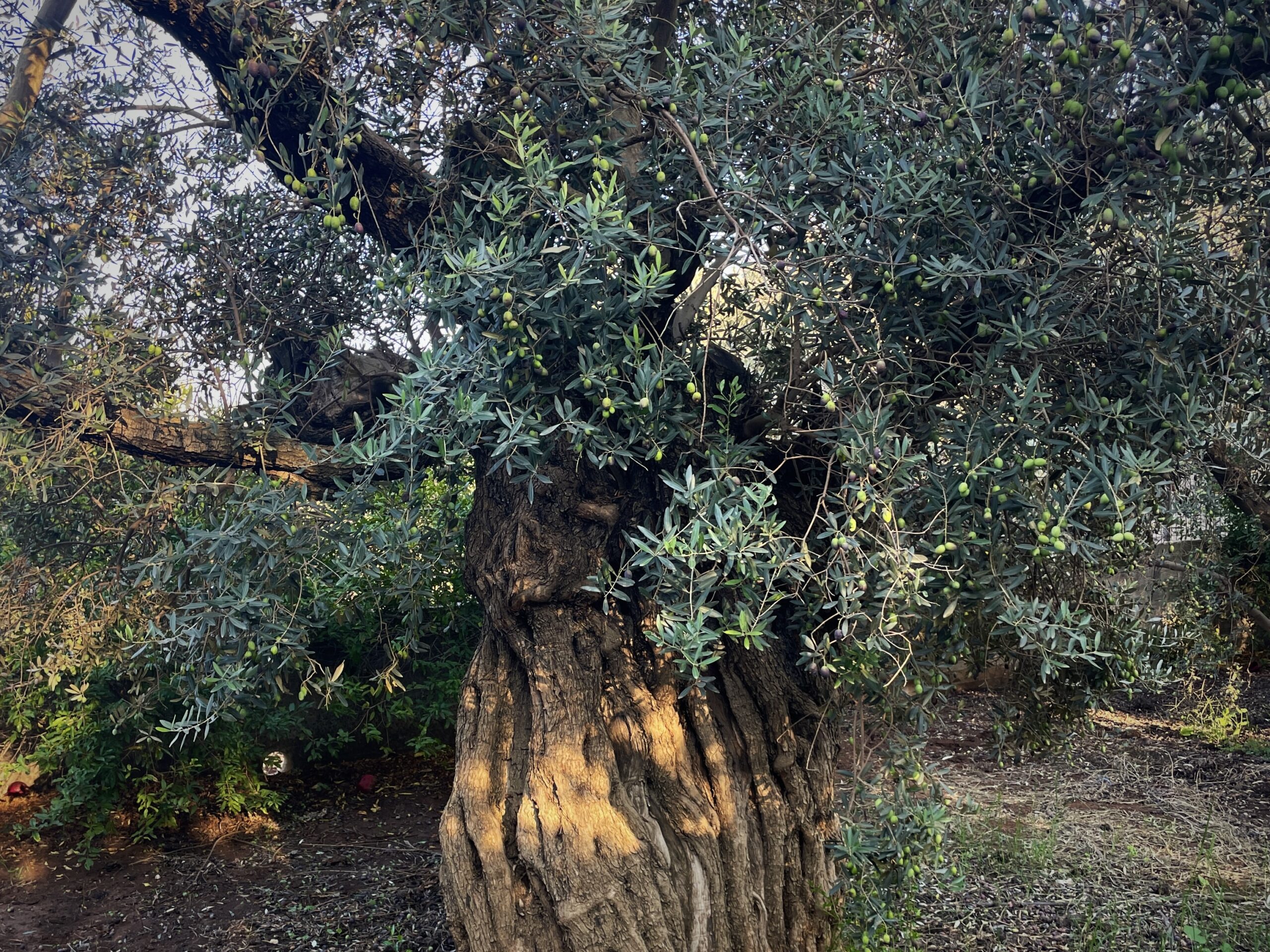
The Galilee is one of the oldest olive growing regions in the world and according to archaeological findings, this is the first region in which olive oil was produced. Since the Stone Age until the present day, olive cultivation in the Galilee never ceased throughout history, seeing various settlers, kings, wars, droughts and natural disasters come and go. As befitting an area of such long-standing cultivation, the region is also marked by ancient olive trees with mighty trunks carrying within them secrets, traditions and long forgotten knowledge.
The Galilee is divided into two central parts: upper and lower. Both were created as a result of earthquakes that formed a mountain range with a relatively narrow valley at its foot. The soil of the Galilee consists mainly of the weathering limestone rocks: chalk turned Rendzina, and dolomite turned Terra Rossa. These soils are ideal for the cultivation of agricultural crops, and olives in particular. The eastern Galilee highlands soil is basalt, a trace of the lava that flowed from the Golan Heights millions of years ago.
The Upper Galilee: the mountainous area between Mount Meron and the Litani River in southern Lebanon. In the west it slopes gently to the Mediterranean Sea, whereas in the east it drops dramatically to the Hula Valley. The peak of the Upper Galilee is Mount Meron, the second highest point in Israel after Mount Hermon. The Upper Galilee is “wild” with streams flowing in all directions and disrupted mountain ranges hence, it wasn’t as densely populated and agricultural as the Lower Galilee. The areas that are suitable for agricultural cultivation, olives included, are Peki’in Valley, Beit Jan Valley, Akrab Valley, Kadesh Valley, the Dalton plateau and the slopes of the Western Galilee.
The Lower Galilee: the region consists of 4 mountain ranges (Nazareth, Tur’an, Yodfat and the short Kamon-Hazon), and 4 valleys (Tur’an Valley which connects to Beit Netufa Valley, the short Sakhnin Valley and Beit HaKerem Valley). This convenient layout is partly the reason the lower Galilee has been continuously inhabited for tens of thousands of years: water sources, roads and an extensive agricultural cultivation area are easy to manage. It is bound by the Nazareth mountain range in the south, Beit HaKerem valley in the north, the sloping plateaus (four of which are in the Galilee region (Arbel, Yavne’el, Sirin, Tabor) in the east, and Alonim, Shfar’am hills and the Zebulun Valley in the west.
The lower Galilee valleys are well drained (with the exception of Beit Netufa Valley), thus olive cultivation spread all over the valleys and the spurs- a vast area suitable for cultivation. The olive groves spread out from one end to the other and traditional farming is the dominant form of cultivation with a large distance between trees. This encourages a large root system that is capable of collecting as much water as possible from its surroundings in preparation for the hot Mediterranean summer.
Archaeological Evidence: One of the earliest findings, if not the oldest around the Mediterranean Sea so far, comes from Tel Tzipori on the western edge of the Nazareth Mountain range, dating back to 6,000 BC. There are countless findings of olive cultivation in the Galilee throughout history to the present day, as well as many traditions relating to the Galilean olive oil.
Varieties: The absolute majority of the olive groves in the Galilee are of the Souri variety.
Harvest season: the harvest season in the villages facing the Mediterranean Sea, situated in the western region of the Galilee, begins in mid-October. It continues into the heart of the Galilee in November, and ends in the east sometime in December. The characteristics of the olive oil correspond.
Organoleptic properties: generally, the region’s olive oils are harmonious and balanced with sharp, well-defined flavors. Usually, the oil in the western villages is bitter and spicier, and is gradually more refined as one heads eastward and into winter (with exceptions, of course).
Oils from the region found at Asif’s Deli: Coratina by Sindyanna of Galilee (Kafr Kanna), Souri by Rish Lakish (Tzipori), Souri by Carmel Saba (Isfiya).
The Coastal Plain
Regional boundaries: The coastal plain stretches from Nahariya in the north to the Gaza Strip in the south.
The Mediterranean coastal plain stretches along 200 km – from Rosh HaNikra to the border of the country, near Gaza. In the north, the coastal plain is narrow, as the bordering mountains are situated close to the Mediterranean Sea. Heading south, the plain widens east, blurring the boundaries between the adjacent regions- the Judean lowlands and the northern Negev.
The northern boundary of the coastal plain is clear and sharp -the Sulam Tzur mountain range rises sharply. To the east, the region is bound by the Western and Lower Galilee Mountain range, the Carmel, Samaria and the Judean Foothills. This is where the southern border connects to the Negev, along the Beer- Sheva-Ofakim-Revivim-Haluza axis. In the west, the Mediterranean Sea forms a natural border.
The coastal plain is usually divided into 6 different parts: Western Galilee, Acre, Carmel, Sharon, Yehuda and Negev.
In the northern part of the coastal plain, from western Galilee to the northern Sharon, the soils are mostly alluvial soils originating from the mountains to the east. Most of the Sharon is covered with many types of soil – kurkar, hamrah, alluvial and terra rossa. The soils in the southern part are sandy soils (originating from the Nile Delta) and loess (originating from the Sahara). Since the type of soil has a significant influence on the characteristics of olive oil, the diverse range of soils found in the coastal plain leads to a wide variety of olive oil styles from the same varieties grown in the same region, sometimes even from neighboring groves.
Archaeological evidence: in the distant past, the coastal plain played a key role in a great revolution that took place in the olive oil industry in the eastern Mediterranean: The Philistines, who arrived in the eastern Mediterranean coast during the Iron Age (1200BC), brought with them iron-smithing and pottery- making technologies as well as industrial presses, all of which enabled the accelerated development of the olive oil industry in the region from then onwards.
Varieties: Souri is the dominant variety in the dryland groves situated in the northern part of the coastal plain. In irrigated groves, the variety composition is diverse and varies according to the plot size and the cultivation method. The most common varieties are Barnea, Coratina, Picholine, Picual and Manzanillo, but also Koroneiki and Arbequina.
Harvest season: The harvest season is also varied with groves harvested early in the season (mid-October), as well as later in the season, in December.
Organoleptic properties: despite the great diversity, the coastal plain olive oils share ‘warm’ floral flavors, and tend to be low in bitterness and spiciness (relative to the same varieties in the Golan or the Negev, for example).
Oils from the region that can be found at Asif’s Deli: Koroneiki by Masik (Kibbutz Magal), Ru’ach-Yam blend by Levant (from Avihayil).
The Jordan Valley
Regional boundaries: The valleys along the Jordan river stretching from the Hula valley in the north to the south of the Jordan Rift Valley, all the way to the Dead Sea.
As far as olives are concerned, the Great Rift valley has posed a significant challenge since ancient times; even within the rift itself, the geographical variation is almost unimaginable: traveling from north to south, one will encounter completely different crops and significant humidity differences every 40 kilometers or so, with the climate shifting from Mediterranean to subtropical, to semi-arid to desert, a total of Four climate zones along a stretch only 160km long.
Traveling from north to south, one will encounter completely different crops and significant humidity differences every 40 kilometers or so
Ehud Soriano
The geographical boundaries of the Jordan valley are clear and defined by the Syro-African Depression: from Kiryat Shmona in the north (250 meters above sea level) to the Dead Sea in the south (400 meters below sea level). The Golan, Gilead and Moab Mountain ranges outline the eastern border, while Ramim mountain range, Safed mountain range, the sloping plateaus (Hukok, Arbel, Yavne’el, Sirin, Zeva’im and Issachar), Gilboa and Samaria mountain ranges outline the western border.
The soil in the north is mainly travertine (a type of limestone rock), partially covered with basalt soil; the Sea of Galilee area is primarily made up of alluvial chalk, marl and basalt soil. The soil between the Southern end of the Sea of Galilee to the Dead Sea is mainly chalk and marl alluvium, with basalt deposits extending to Emek HaMa’ayanot.
Archaeological evidence: there are dozens of ancient oil presses remains in the Jordan valley dating back to the copper age (7000 years ago), the Iron Age and the Roman, Byzantine, Arab and Mamluk empires.
Varieties: It is difficult to talk about a dominant cultivar along the rift. Koroneiki, Arbequina and Askal are the dominant varieties in places where the harvest is executed by a modified mechanical grape harvester. Since the harvester was designed to harvest grapes, the olive trees are densely planted along an ‘avenue’, similar to grapes (this planting method is also called ‘high density’ or ‘super-intensive). Picual, Coratina, Barnea and Picholine are commonly grown in places where the harvesting is done using a mechanical olive shaker (an agricultural tool that attaches to a tractor and uses vibration to release the fruit onto nets spread on the ground, by hooking the trunk and shaking it).
Harvest season: when the summer is long and hot, the accumulation of oil is delayed and ends late in the season. As surprising as it sounds, the harvest reaches its peak at the same time it does in the Golan Heights, which is about 600-700 meters higher(!) – starting in mid-November and well into December, sometimes even January.
Organoleptic properties: due to the high temperatures during the summer and the late ripening, the Jordan valley olive oils are usually refined with round, ripe flavors.
Oils from the region that can be found at Asif’s Deli: Asi’s Koroneiki (from Emek HaMa’ayanot).
The Negev Plateau and Mountains
Regional boundaries: the Negev plateau and mountains stretching from Be’er- Sheva to Mitzpe Ramon.
Despite the arid and inhospitable conditions, life flourished in the region throughout.
In the north, the boundary is along a connecting line joining Haluza sands, Be’er Sheva Valley and Arad Plateau and in the south, it is bound by Makhtesh Ramon. Tzin Valley forms the eastern boundary, and the political border line with Egypt is on the west (although geographically it continues further into Sinai).
The Negev Plateau extends from the northern border all the way to Tzin Valley, HaBesor Stream and HaZiporim Stream, 200- 500 meters above sea level. The majority of the soil is loess that originates from the weathering of the Negev and Sinai mountains rocks. The western and northwestern parts of the Negev plateau is the Nitsana and Haluza sands.
The Negev Mountains begins where the Negev Plateau ends, and continues south to Makhtesh Ramon, 500- 1000 meters above sea level. In the Negev Mountains the soil is also mostly loess, with the Nitsana and Haluza sands in the western edge.
Archaeological evidence: the golden age of olive farming in the Negev (and agriculture in general) began when the Nabateans took over the region in the 3rd century BC, and with the fortification of the perfume road stretching from the Arabian Peninsula to the port of Gaza. The fortified roadside inns also served as agricultural settlement centers with a variety of creative solutions for storing the low amounts of rainfall, routing floodwaters and maximizing the use of the collected water.
Today, olive farming in the Negev Plateau and the Negev Mountains is highly developed and modern, maximizing water usage; not only rainfall, but also from below the surface – brackish groundwater is used for irrigation, one of Israel’s most impressive agricultural breakthrough innovations in generations.
Varieties: Picual, Souri, Barnea, Coratina, Koroneiki, Arbequina, as well as several others.
Harvest season: the harvest season in the Negev, as befitting a high and cold region, begins late, in November, and ends in December.
Organoleptic properties: The Negev Mountains olive oils are usually harmonious, with strong and sharp well-defined flavors.
Oils from the region that can be found at Asif’s Deli: Souri by Marom Farm (from Mitzpe Ramon), Koroneiki by Mashkit Farm (from Mitzpe Ramon).
Ehud Soriano is a certified olive oil expert from the University of Jaén, Spain. Soriano is an advisor for olive oil producers in agronomy and oil production. He teaches and lectures on olive oil in Israel and around the world and serves as a judge in international competitions.